One of the finest parts of Iceland is the district of Thingeyjar Sysla, to the E. of Akureyri, with picturesque scenery and of grand volcanic 1912. DSC_0452
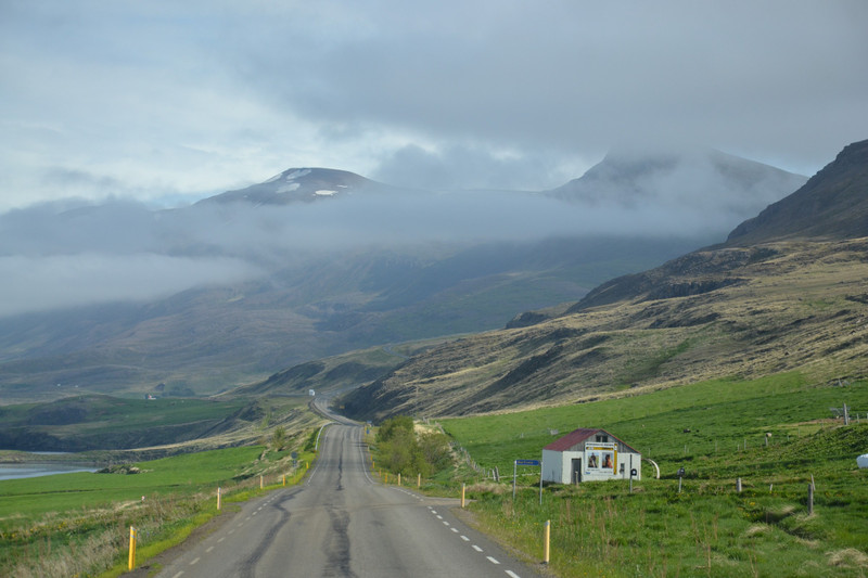
Now on the other side of the Eyjafjrur from Akureyri, the coach ascended the slope of Valaheiar mountain. Rather than go around it, we took a tunnel through the mountain. At the other side of Valaheiar the road descends to traverse the valley of Fnjskadalur. The highway generally followed the course of the Fnjska River through farming country. Presently we arrived at Goafoss, the Waterfall of the Gods. The falls are not that high, but they are wide and create a roading rapids in the Skjlfandafljt River. The tourist legend is that the Alþting lawspeaker threw the images of Thor and the other Nordic gods into the falls when Iceland converted to Christianity in about 1000. However, it is more likely the name derives from two rocky promontories below the falls. A path leads from the visitor center and cafe along the rapids to the falls. A shore excursion tour from the Hurtigutens Spitsbergen was also here.
The highway continues on to follow the shore of Lake Mvatn for a distance. Lake Mvatn is a refuge for any number of types of waterfowl.
Valaheii above Eyjafjrur. We ride up the Valaheii (2326 ft.), obtaining a fine view of the fjord with the sea beyond ...Baedeker 1912. DSC_0454p1
The lake if of volcanic origin and it marked the passing from the rolling, if rocky, farmland and forests of Fnjskadalur into a geothermal region. Not far from the lake is the Mvatn Nature Baths. Its North Icelands answer to the Blue Lagoon. The Caf Kvika on the property was our lunch stop. Icelandic Hot Dogs here too! There was not time for tour members to take a dip, but the cafe seating area looked out upon the geothermal pool and its bathers. Like the Blue Lagoon it is an artificial pool, fed by hot water from the nearby Bjarnarflag Geothermal Power Station. Just over Namaskar pass from the baths was another large hot springs, the Nmafjall Geothermal Area. This was was a most dramatic sight. There were no geysers, but plenty of bubbling and steaming hot springs. The hot springs landscape and adjacent Namaskard mountain were colored in shades of bright yellows, oranges and burnt umber. The site reminded me of the Painted Desert in Arizona and the Devils Paint Pots in Yellowstone. The presence of rhyolite causes the coloration. A sulfurous odor wafted over the area.
Fnjskadalur Valley with the Fnjska River. We ride up the Valaheii (2326 ft.) ... and then descend into the valley of the Fnjsk (Fnjskrdalur). By the parsonage of Hls, a little off the 1912. DSC_0457
of cairns appear alongside the highway. It was explained that these are traditional Icelandic road or track markers. Highway 1 follows their alignment in this region of northeast Iceland. Dettifoss is surrounded by an expansive basalt lava field. I fear Susan and I did not make it all the way along the path to view Dettifoss. But we did see the canyon of the Jkuls Fjllum river below the falls.
Afternoon break was at the Guesthouse Skjdlfsstadir. Here we enjoyed Pnnukkur (Icelandic Pancakes) and hot tea. The pancakes are rolled in the manner of Pigs in a Blanket, but rolled inside are jams and jellies. On the property was a curious wooden structure. I must say that even our guide was mystified by it. Later, I learned it was built to honor a local couple who spent time in the north of Norway. It is in the style of a Sammi Lavvu, a temporary dwelling that very much resembles a Native American tipi. We missed Dettifoss, but Iceland presents innumerable roadside waterfalls as glacial runoff is carried over mountains and hillsides. One such was just beyond the guesthouse, Rjkandafoss. Rjkandafoss came down the hillside in two streams,
Goafoss - Waterfall of the Gods. ...the Skjlfandaflt forms the (20 min.) Goafoss, 39 ft. high, a broad waterfall of horseshoe 1912.
