The mountain range of Velebit we have described a bit in an earlier blog as we travelled from Vodice to Zagreb. Now it was time to stop there and do some hiking. Hiking in summer can be tough, as it is excruciatingly hot (temperatures can reach 30C). Hiking there in October is tough as it can be very cold. In winter temperatures drop to -20C. What is always expecting the hiker is the total unpredictability of weather, a fast changing weather situation, with high winds and sudden dense fog, but also its intimidating beauty.
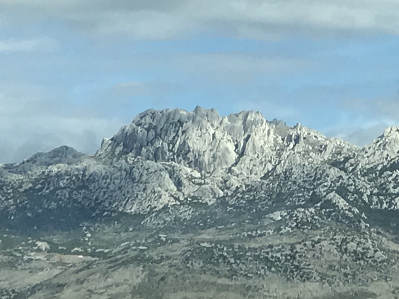
The mountain range stretches about 150km from to following the Adriatic coast. It is a weather divide, separating Croatia into a Mediterranean climate zone on its western side and a Continental zone on the eastern side. It is also a cultural divide, separating the former Venetian Republic territories of the Balkans from the Hungarian/Croatian areas of influence. The Velebit has 70 peaks higher than 1600 m altitude, with the Vaganski Vrh (1757 m) in South Velebit as its highest peak. The important characteristic of Velebit is its simple, solid, monolithic form, stiff cliffs, and the nakedness of seaward side and the vast forest covered
slopes on the Eastern side called the Lika region. The basic geological characteristic of the mountains is karst. Flora and fauna are abundant on the East, but much more sparse on the Western part. The whole mountain range is protected as nature park, with two dedicated National Parks, the Northern Velebit National Park and the Paklenica National Park. There are hundreds of holes on Velebit. It has the largest and deepest caves in Croatia. The Lukina jama cave is 1392 m deep, making it one of the deepest caves in the world. What makes it unique is that it vertical. At the bottom of the pothole is a water course or siphon with branches that are still unexplored.
A pathway called Premuićeva staza (Premuićs pathway) leads through the northern and middle parts of Velebit. This pathway was built between 1930 and 1933 and it connects northern and southern Velebit. Its length is 57 kilometres. Many parts of Velebit would not be reachable without it. For serious hikers there is the Velebit hiking trail of around 100 km in total, following almost the entire length of the range. It is well marked with the mountaineer markings. It
will take 9 days of walking to pass the entire route and prior bookings in the simple but adequate mountain huts is required for overnight stays. We did not hike this 100km route, which Nenad in hindsight says, we should have done (!!!). But we drove in the Northern Velebit region the highest mountain pass called Otarijska vrata at 928 m connecting Karlobag and the drive with some hiking and in a second attempt we entered the Paklenica National Park.
Our first hike was short as we were coughed out by bad weather. With no other hikers anywhere near, the cold and the fog engulfing with strong winds gave a real wild appeal. Nenad grew up with mountains in Switzerland and is well aware of the dangers the weather can pose. So our hike was only four hours, nevertheless reaching the top of Ljubicko Brdo at 1320m, giving us some steep ascends (and descends) and a good feeling of the wild beauty of this region. Filipov Kuk, a famous rock very popular with the rock we did not mange to reach, as the rapidly worsening weather and visibility made us to abandon the
A couple of weeks later we tried again a bit more South in the Paklenica NP. This time the weather was on our side, as we better could not have wished. A wonderful Indian Summer day has given also the Velebit mountains pleasant temperatures, perfect for a hike. The hike was sweaty nevertheless, as Velebit has extremely steep ascents and descents. The paths are often non existent, but just a heap of sharp rock that we had to walk on. One can find no walking rhythm and keeping the balance on these rocks is a constant challenge.