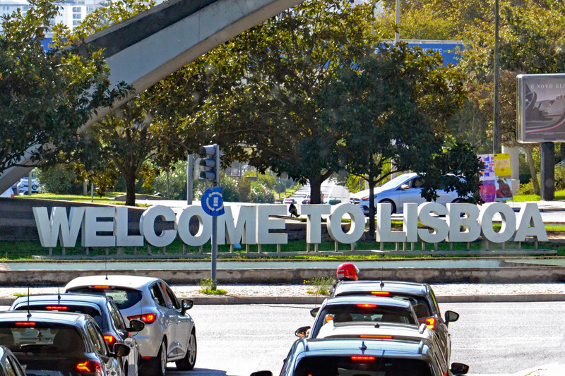
Having faced unexpected trials and tribulations during my first three days on the Larapinta Trail, it was with a fair degree of trepidation that I rose to greet the day on Thursday (August 12th), knowing that - according to the map guide at least - I was about to face one of the most difficult days on the trail. Still, it also promised to be one of the most spectacular, with the route climbing up and over the Chewings Range before descending to a campsite near a picturesque waterhole. Despite wasting fifteen minutes trying to buy a lip balm from the kiosk at Standley Chasm (the less said about that the better) I managed to get going by 9am, as planned. The fact that each of the three ladies with whom I had been camped had gotten underway a full before me I considered irrelevant. They were clearly more acclimatised to the cold mornings than I was.
After paralleling the access road south for five hundred metres, the trail then took a turn and followed a dry creek bed for the next kilometre, before turning sharply again and beginning to climb up the side of a valley towards
a prominent saddle at the far end. With doubts still swirling around my head after my suffering of the previous day, I was surprised to find myself powering up this slope - despite the fact that I was carrying 6 litres worth of water, which would have brought my total pack weight to around 24kg - and was astonished to find myself at the Bridle Path Lookout by 10am. I had covered 5km with 200m of elevation gain in exactly one hour, without stopping once! Where had this sort of energy been yesterday?!? Admittedly the temperature was only forecast to hit 20° - where the previous two days it had reached 28° - but surely that alone didnt explain my performance. I dumbfounded.
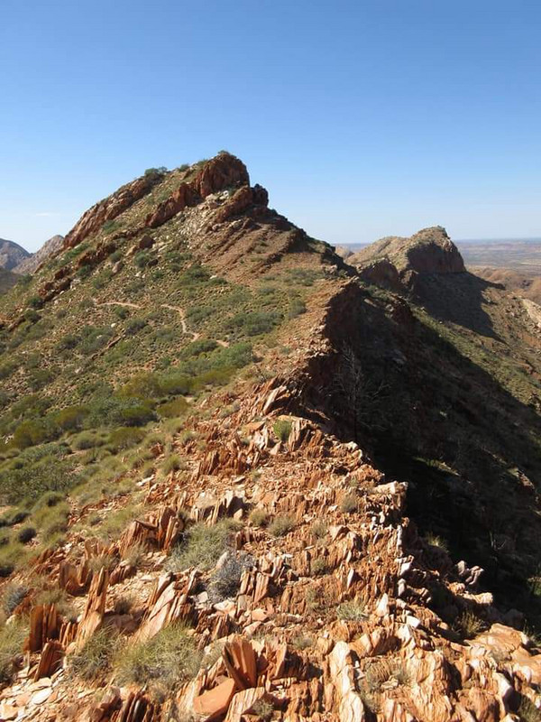
With views of plunging ravines, sweeping valleys, shapely peaks and faraway horizons, it wasnt just my hiking prowess that had me shaking my head in amazement. But what REALLY blew me away was the wind: the forecast had predicted gusting up to 60km/h, and if anything that forecast seemed to have been on the conservative side - damn, it was windy!!! Never would I have imagined I would be ADDING layers
of clothing during a sweaty climb up a mountain in the heat of the Outback, but thats exactly what happened. And the higher I climbed, the stronger the wind got. But so too did the views get better and better, with the colossal geological forces that have shaped this land being displayed to full effect. The amount of force that must have been required to take horizontal layers of rock (laid down over a billion years ago when this area was a river delta) and buckle it until it was tilted at all manner of different angles - from diagonal to vertical - is simply And yet everywhere I looked, angular slabs of rock striped with layers of rock stared back at me. This was the ancient landscape that I had yearned to see for myself, and the Larapinta Trail was laying it out on a platter for my viewing pleasure.
After negotiating the numerous peaks and troughs of this of a ridge, I eventually arrived at the highest point in this section of the Chewings Range: Brinkley Bluff, at 1209m above sea level. This also happens to be the highest point reached by the
Larapinta Trail until it ends on the summit of Mount Sonder, which was still well and truly out of sight over a hundred kilometres away to the west; and as such, the summit was marked by a gigantic rock cairn about three metres high! I had thought the summit cairn atop Mount Bogong in Victoria was impressive, but this one would definitely give it a run for its money. Still, the mountain does only rise about six hundred metres above the surrounding plains, which makes me wonder if theyre not slightly.
But at least the pile of rubble atop Brinkley Bluff offered some semblance of shelter from the wind, without which I doubt I would ever have been able to boil the water necessary to rehydrate my beef teriyaki for lunch.

Travelmates near