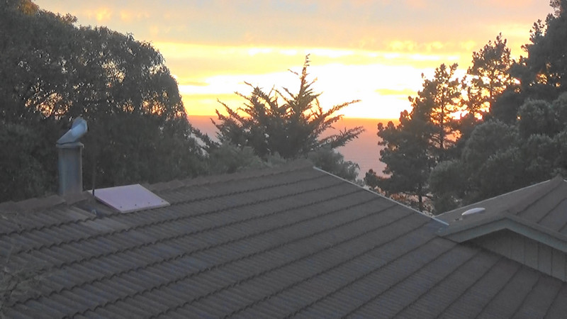
As we hoped for, the norwester wind that had sprung up during the night calmed down as the sun rose rather dramatically from the sea on the horizon.
Breakfast on the terrace in already a warm temperature was a pleasant experience and it might have been easy to say ‘lets just kick back and not go tramping off into the forest today.
However, we have only one full day here in Gore Bay so we best make the most of it and stick to the plan of 2 forest walks.
The first was the Tweedies Gully trail through bush and uphill to a fine lookout both to the north and south of the bay.
The track was relatively easy except for one landslip to negotiate where ducking under a large fallen tree and then over its branches was the most difficult part.
Gore Bay has reportedly only a small permanent population of 14 people although there are a few more houses than that, many being holiday homes.
And this being the weekend there were more people around although not on our upward climb through Tweedies Gully.
was one of the first settlers in Gore Bay and owned a large amount of the land in the general area. He was born in Scotland in 1852 and emigrated to Christchurch in 1865 where he worked at his trade as a carpenter until he moved to the Cheviot when the town was established in 1894 and was responsible for many of the early structures built. He then settled at Gore Bay in 1898.
We only met 2 other people on our way up the hill.However,during our short rest at the top other people emerged from the bush and we began to wonder if all of the holiday population were out taking the trail on this fine, sunny morning. That thought continued as we started back down the trail and by the time we reached the bottom we had counted 20 others on what we first thought would be a quiet stroll.
It was just after midday when we emerged from the bush and back to our car realising that we had forgotten our packed lunch which we had left back at the apartment, so lunch on a bench overlooking the ocean and the solitary surfer trying to
A quick stop back at our apartment and we met up with John, our host and chatted with him finding out about his disability after a mining accident and a life thereafter which has and still is being fully lived. Chatting with him was an inspiration for getting on with and enjoying life!
The next trail we thought was going to be from Port Robinson to Manuka Bay and we drove to where we expected the start of the trail to be only to find no indication of where to start. We then remembered that John had said it might be an option but the trail wasnt a DOC walk and could prove a challenge.
Port Robinson sounded interesting as it served the Cheviot area in the late 1800s through to the 1950s with small vessels anchoring offshore and small surf boats bringing goods ashore and taking off farm products including wool. The port had been busy enough for a small population and a school set on the cliff above the rocks.
Manuka Bay and reversed the car so we could have a boot lunch as there were no picnic tables or shade to sit under.
There was a sign showing the way to the walk between the bay and the Hurunui River Mouth. The sign said 4.8km distance and the DOC leaflet said 6km return. Which one was right? and were we up for another 6km of bush trekking?
The decision made to proceed and we headed off along a track that ran the length of the long beach on the other side of the sand dunes from the ocean. Initially this track looked like it would eat up a fair amount of the 6km return journey.
However, good to an end and the beach finished and then there was just a rocky coastline with a headland that you couldnt see beyond.
The track headed towards a steep hillside covered with bush and after a further discussion we decided to carry on as long as the climb didnt get too steep.