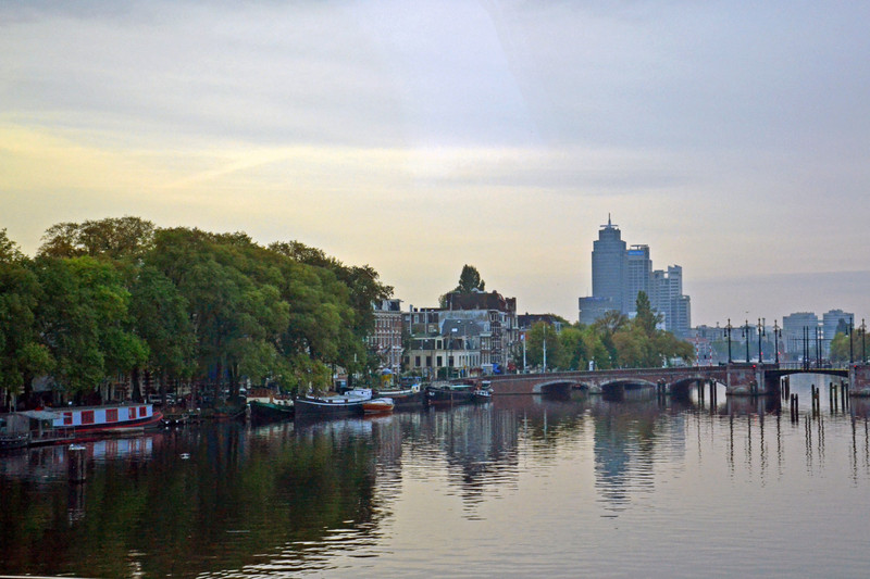
Amsterdam is inseparable from its canals. It is impossible to visit Amsterdam and not encounter the canals in some way. They form concentric rings around the city, radiating out from the harbor area. The outermost canals have defined the city limits over the centuries. As the city expanded, new canals were dug. The Prinsengracht defined the city limit in the 17th century. By the 19th century, the city had expanded outward and the Singlegracht then formed the boundary.
Construction of the inner canal belt system began in the 16th century and continued into the 17th century coinciding with the rise of Amsterdam as a and shipping capital. During this era, the Dutch Golden Age, merchants and the grand townhouses along the canals in the distinctive Dutch Renaissance style. The canals were meant to traffic, connecting business with the harbor, very much like the canals of Venice. Like Venice, some of the canals have been filled in over the year and streets. Unlike Venice, motor vehicles, trams, and cyclists use the streets running alongside and over the canals.
Amsterdam Centraal - Amsterdam Central Station. Designed by Pierre Cuypers with the distinctive roof designed by L.J. Eijmer. Gothic/Renaissance Revival style, opened in 1889. Stationsplein 15. In the centre, on one of these islands, lies the Central Railway Station, a large building in the Dutch Renaissance style, designed by P. J. H. Cuypers and opened in 1910 DSC_0575p1
canal cruise boat was right down by Centraal Station. A good chance to inspect the architecture of this grand railway terminal, done up in the Dutch Renaissance Revival style popular in the 1880s. (No time for train spotting, though.) It fit in well with its surroundings.
The canal cruise took us around over Prinsengracht, Leidsegracht, Herengracht, the Amstel River, Oudeschans, and out into the Oosterdok. It was a great way to see old Amsterdam, a part of the Jordaan, and all the new building activity in the harbour area, all from water level. Amsterdam seems to be reusing its former harbour dock area for new building construction. I can only conclude other means have been found to support seagoing trade or it has moved away from central Amsterdam altogether.Amsterdam Centraal Station (1882).The 21st century structures offer a contrast with the 17th to early 20th century buildings lining Prins Henrikkade across the way.
Townhouses in the Dutch Renaissance style line all of the older canals. They range from mansions along Herengracht to simpler, but no less attractive, houses and businesses lining Prinsengracht. Along newer canals like Singlegracht, one finds 19th century buildings, parks, hotels, restaurants and museums in a
variety of styles. A surprise is the number of houseboats on the canals. They are in all styles, from ones that look like boats to ones that look like floating boxes. The city has imposed a cap on new houseboats, so in order to own one, you have to buy an existing one. Thus, supply is limited and they can be very expensive! The inhabitants personalize them will all sorts of decorations and plantings.
The canals can be explored at street level on foot or bicycle. Or you can explore them by sailing on the canals themselves. There are two ways to do this. The Canal Bus runs three lines from Central Station as far as Museumplein. There are also narrated canal sightseeing tours operating similar style boats. Either way, I really seeing the canals at water level! I liked the way each canal house has a hook at the top for lifting items to the upper floors. Houses are narrow and space at a premium, so there is no room for wide stairs to bring things up from the inside. I have to say I did not know there were so many houseboats on the
Building with facade under cut straight list of consoles. 19th century. Prins Hendrikkade 12. Building with heavy gable, Anno 1740. Prins Hendrikkade 14.