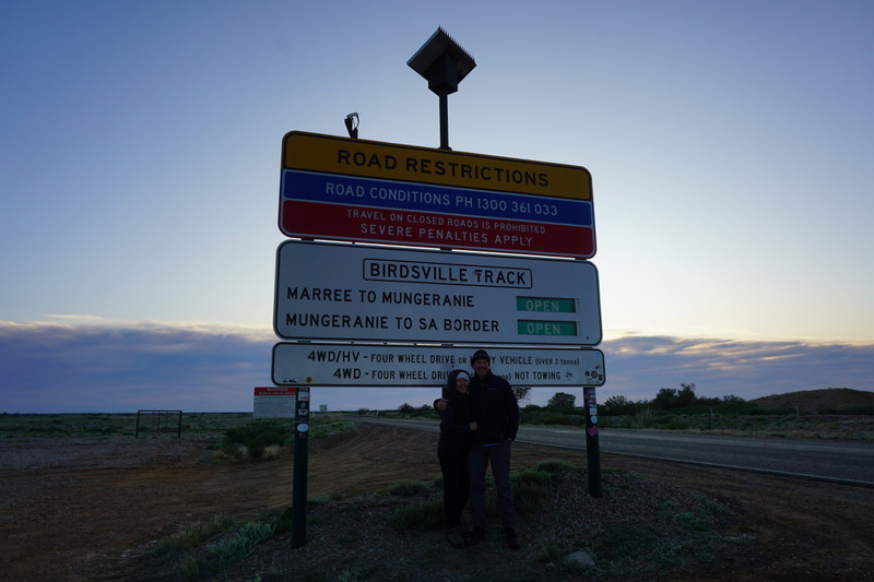
We were quite excited to leave Marree to tackle the icon of the Aussie outback, the Birdsville Track. Before hitting the Track, we replenished out water tank. Dave and Kerry Date followed us out to the sign and we took the memory photos.
Birdsville Track was created in 1860s by drover Percy Burt to avoid the main hazards of the Diamantina floodplain. We found the track conditions from Marree to Mungeranie quite smooth however that changed to rough heading north from Mungeranie. The surface was generally dry on a sandy base covered with large pebbles (very large) called gibbers. Our travelling speed varied depending on the varied road surface as caring for our tyres was a priority. At no stage have we underestimated the outback conditions. We had read that there are many serious accidents on this track and with the huge number of vehicles on the track today, all heading for The Big Red Bash, extra care was taken by us. There were still many selfish idiots on the track. The reasons usually came down to driver error, with sudden braking at speed on slippery gibbers playing a big part. They have rounded edges and are piled
thick. You can hear them crunch beneath your tyres. They are also prone to be kicked up by rear tyres and flick back to cause stone damage on trailers, rear windows and passing windscreens. We were fortunate today that a few cricket ball size stones were flicked up by speeding passing idiots, bounced in front of us and not on our windscreen. The gibbers make for difficult traction if you start to slide around a corner and many cattle grids appear quite unexpectedly hence keeping our speed to what we could handle with our Prado towing the XTRK. Bulldust holes were in this section too. We kept our tyre pressures lower than normal to improve traction.
The Birdsville Track is surrounded by deserts. Sturts Stony Desert in the southern and central parts (north of Mungeranie), and the Strzelecki and Simpson Desert in the north. Despite the apparent barrenness of the region, the Birdsville Track area is considered good cattle country. In fact, organic beef is produced in this area, with livestock free from ticks and hence no need for chemical treatments.
was onto the expansive Clayton Cattle Station. Dulkaninna followed, before we arrived at Etadunna and Coopers Creek where surface water was very low and only in puddles.
The Natterannie Sandhill was next. Our information showed that their height varied between 31m to 37m. It is covered in low shrubs. Heading towards Mulka Station we passed the Ooroowillannie ruins. We wandered around the Mungeranie Pub and camping area and decided to head onto Tippipilia Creek, a further 132kms on, and set up camp. We collected firewood, prepared the wood for burning, which Kerry wanted to do at 4 oclock but we held her off until 5.15pm. With good tucker and good wine in our bellies and a roaring fire, we watched the sun set and settled into a long night of varied conversation and laughter. The sky was filled with stars that you felt you could reach up and touch them.