We HAD eagerly set off for our destination, Kaltukatjara (Docker River), where we HAD planned to stay 2 nights.
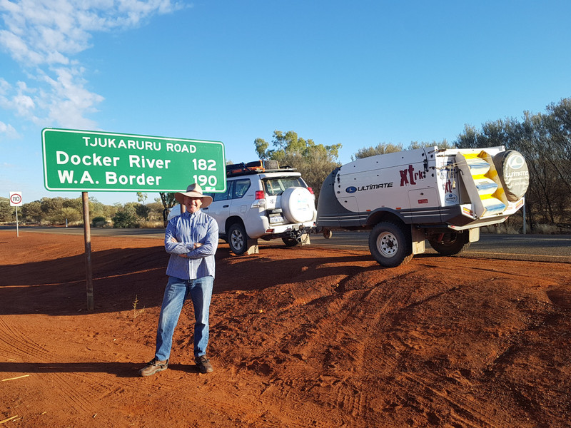
50km from Yulara and with Kata Tjuka at our backs we photographed the road signs to the WA Border and Kaltukatjara and the road ahead knowing that 95% of the over 1000km to Laverton would be unsealed. The road that we covered today proved to be worse than what we had heard. Bone shaking corrugations over many varied surfaces, stony surfaces the worst.
Before arriving at Kaltukatjara, we turned off the road and followed a track that led us to Lewis Harold Bell Lasseters Cave. The photograph of the plaque at the cave site tells of the why and what. Onto Kaltukatjara, a remote in the Northern Territory, overlooked by the Petermann Ranges and only 8km from the WA border, for our stay not a chance. With disappointment and sadness etched into our faces we departed within of arriving. Enough to say that both of us spoke at length of what we had seen and how it could be improved.
continue to Warakurna Roadhouse, 121km further west near the majestic Rawlinson Ranges. The residents of the are mostly Ngaanyatjarra speakers. We stopped for 3 Aboriginal women between Kaltukatjara and Warakurna who had run out of drinking water. We left them a 15L container filled with fresh water. They were also waiting for their vehicle to cool down as it had overheated.
The Giles weather station, a fully functioning meteorological observation station, is also located at Kaltukatjara. We were the only campers. From the barriers on the fuel pumps and the warnings to visitors we see that has or has had its problems. The elders of are trying very hard to eradicate fuel sniffing, drugs, and alcohol.