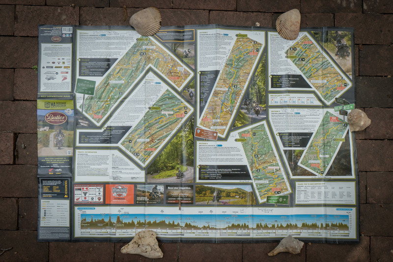
It took me half a days ride to get home again. The Mid Atlantic Backcountry Discovery Route is 1,058 miles long. It was designed perfectly for access by residents of the Washington Metro Area. From Arlington to the Start at Damascus VA is some 355 mi and 5 1/2 hours. From the Finish in Lawrenceville PA back to Arlington VA is about 268 mi and 4 1/2 hours. If one were to just drive via interstate from Damascus to Lawrenceville, it would take about 9 hours and cover 555 miles. By riding the mountains and forests, it takes 9 days, and over 1,050 miles. Campsites are available. Hotels are plentiful (I always stayed at hotels) and very aware. Shields and cleaning emphasized everywhere. Food and gas are easy to find -- but dont pass them by, you may regret it.
The official BDR website is very good: . You should buy the MABDR Butler map from them, read the FAQs, and download the free GPX files for your GPS. Upload the GPX files as Tracks. They should show up under Custom Routes. Then change a bunch of settings on your GPS to make it possible to follow these
tracks. Under the Navigation setting, turn OFF the Recalculation function, and set the Route Preference to Off Road. Under the Map setting, turn OFF the Autozoom function, and set Map Data Layout to More Map view . I also set the Map view to North Up. Helps get your bearings. With these adjustments, your GPS should be good to go. Note that these GPX tracks do NOT give you a route. They tell you the inflection points along the route -- i.e. where the route changes in direction -- the corners. You fake your way from corner to corner, sometimes riding widely away from the straight line GPS route. Not to worry. As long as you come back hit the corner EXACTLY, you will be OK. Then take the new relative direction.
I have done the route twice on my own. I am 69 years old, and have been riding for maybe 15 years. Yes, I have taken the BMW course in Greer SC (good value!) . The route is safe, if driven carefully with an eye out for weather. Maybe 3/4 of the route is gravel or clay. The Southern half of the route is more problematic
because of the clay contour roads. The latter quickly get difficult in the rain. It takes maybe half a day of sun to dry out again. The Northern section has a lot of well graveled straight forest tracks which can be ridden in the rain with no problems. I have never fallen, though I came close a few times. It pays to have stiff, high, riding boots, knobby tires (TKC 80 s are the best) and not carry too much weight up high. If you have big knobby tires, remove the mud guard thing on the back wheel, or it will break off when you hit mud. You are also well advised to take an driving course to get the principles of gravel and mud riding. The smaller and lighter the bike, the easier the ride. I rode a 2012 BMW R1200 GSA also known as the last oil cooled hex heads with some 75,000 miles on. It never hesitated. But it is big and heavy. Had to learn NOT to fill the 8 gallon gas tank, or the bike became too heavy to maneuver.
break my leg, I carried a Garmin InReach MINI It has an automatic SOS function, that will alert rescue services and give them your location coordinates. It also provides a simple texting service that you can use to let loved ones know where you are. It will also track your progress by recording your location every so often -- but this uses up a lot of battery so I never use it. Otherwise, one battery charge will last the whole trip. The rescue service insurance is not cheap, but worthwhile. It allows you to step out of the service when you are not using it, and then return when needed. Very useful gadget.
There seems to be a continuous flow of other rides on the trail, so that someone should find you should you need assisance. Of course, you actually only meet those going in the opposite direction, but there is enough traffic to help you out over the course of a day unless you are in a dire emergency.