A windy night gave way to an overcast Friday morning as I prepared to leave Marree. A few drops of rain falling on the dusty ground hinted at what was After leaving the Marree Hotel, I had to get some fuel and buy some bread. While there, an optimistic fellow asked me about conditions up the Oodnadatta Track. I told him it was fine when I came down two days ago, but with the rain closing in, I didnt like his chances.
I drove south on the bitumen for a bit over 100km – the longest stretch of sealed road I had driven on for a few days. As I headed south, the flat landscape gave way to rising hills, and I knew I was approaching the Gammon Ranges – the northern part of the Flinders Ranges.
At Copely, I turned east and returned to gravel roads. So far, the weather had held off; I encountered only a handful of raindrops since leaving Marree. So I pushed on with my plan to drive to Arkaroola via the track through the Gammon Ranges National Park, instead of keeping on the road via Bulcanoona.
the Umberatana Road and was surprised that it was little more than a track. I wasnt even on the track yet, and already my speed had been reduced greatly. By the time I turned off on the track to Indinha, the rain was closing in. I reached the Indinha Outstation and decided to stop for lunch. Fortunately, the rain eased off so I could make a sandwich without getting wet, but shortly started again so I ate in the car before continuing on.
The track was reasonably easy at that point, but as I turned down the track heading south to Grindells Hut and Loch Ness Well it became more of a challenge. The views were amazing, especially at Gills Lookout where I had to stop and take a photo, despite the weather. The track had bulldust holes that caught me off guard a couple of times, so I was going pretty slowly. I stopped at Grindells Hut and took a couple of photos, but what I thought was the historical hut turned out to be a later building that is now used for tourist With the weather closing in, I decided to skip looking for
It was fortunate that I did, because I arrived as the rain started getting heavier. As I checked in, they told me that the roads were expected to be closed soon. Thankfully, I would have a roof over my head when the storm hit that night. Less fortunate was the news that most of the tracks around Arkaroola would be closed too, and they werent sure for how long. I settled into my room, had dinner in the restaurant and went to sleep with the sound of rain lashing down.
It was still raining in the morning when I went for breakfast. There I saw that as expected, the roads were closed and so were all of the tracks except for one walking track. As I had changed my plans to start my stay at Arkaroola a day early, I thought of it as a bonus day anyway, so I headed back to my room and returned to bed. I spent the morning having more sleep and watching tv. Around lunchtime, the rain had finished, and the sun came out.
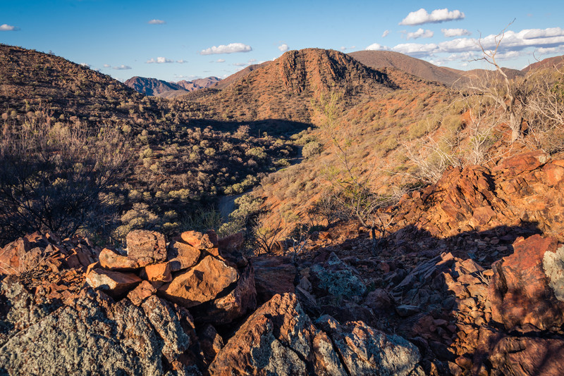
I got myself moving and headed out for the walk through the Mawson Valley. The views through the valley were fantastic and a great taste of things After reaching the end of the Mawson walking track, I reached the Pinnacles. I dont know how many pinnacles there are, I know of at least 2 other places that are called that in Australia. But they were some pretty impressive rock formations. I returned to Arkaroola via the Spriggina walking track. It was a total of 8km, so not too bad for a lazy day.
On Sunday morning I woke up worried that I would be stuck in Arkaroola for 4 days with nothing to do. However, when I asked about the tracks, I was told that even though the roads out of Arkaroola were still closed, all the tracks were open except for the Echo Camp Backtrack – the toughest 4wd track open to the public. Hopefully, it would be open on Monday, so I set out to see some of the other sites. I also booked a Ridge Top Track Tour for Tuesday, the day I leave.