Today we make our way to the wetland park a World Heritage Site in St. Lucia. The longest drive is awaiting us. 608 km from Hazyview to St. Lucia a coastal town on the Indian Ocean, close to the border to Mozambique. Due to Covid the borders to Swaziland are closed. Our original plan to drive through this small, independent country had to be changed. Swaziland, officially called eSwatini covers an area of 17,364 km², it is one of Africas smallest countries, slightly smaller than the U.S. state of New Jersey. The country is known for its game reserves with diverse wildlife. But also for the highest tuberculosis and HIV rate in the world. Swaziland has a population of 1.4 million people (est. 2015). Autonomy for the Swazis of southern Africa was guaranteed by the British in the late 19th century; independence was granted 1968. Student and labor unrest during the 1990s have pressured the monarchy (one of the oldest on the continent) to grudgingly allow political reform and greater democracy,
Early we packed and headed off. The rains from last night were not clearing and we started the day under heavy downpours and very dense, foggy conditions. Not
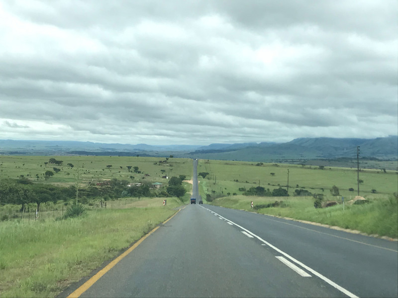
only was the driving a bit more strenuous; driving on African roads means not only looking out for reckless minibus drivers and overloaded lorries, but also people and animals who at any time can cross or jam the road indiscriminately. What was far more important we were deprived of the spectacular views as we travelled from the Middelveld to the Lowveld and further to the coast. Passing the towns and points of White River, Nelspruit, Hilltop Pass and Piet Retief along the border of Swaziland, we could only guess what we were missing out. Quite frustrating to have now this, after the wash out on the Panorama Route. Well, our luck with the animal sightings in us. And again, Nuis smile, who found this not to be so dramatic and the fog painted landscape actually quite nice, gave Nenad a positive twist to the drive. We passed White River, a famous for its agricultural produce (and indeed we must say, we seldom ate fresher salads than in the North East), Nelspruit, today called Mbombela, the provincial capital of Mpumalanga, founded by three Boer brothers in 1895, and the Hilltop Pass with an altitude of 990m and
Further South in Piet Retief the weather improved and so did Nenads mood. We stopped in a lovely small restaurant and after a delicious pasta the world looked far better again. The town of Piet Retief was named by a Boer who led one of the Voortrekker (the Great Track) caravans inland, when the Dutch/German Lutheran settlers wanted independence from British colonial rule they were subjected to along the South African coast. We met him already at the Voortrekker Monument in Pretoria.
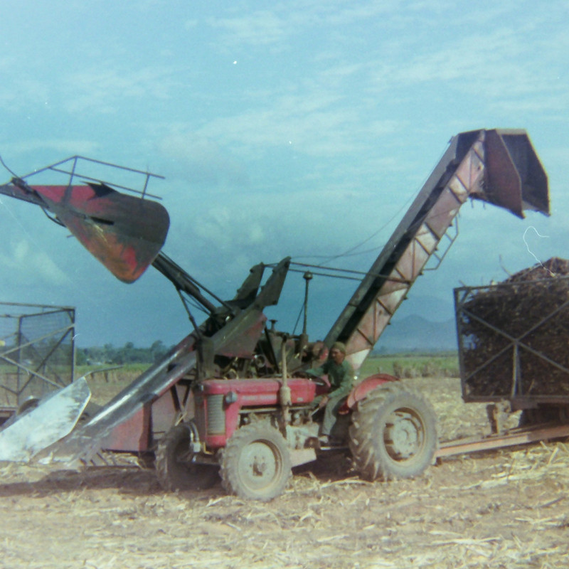
On the road to St Lucia, we continuously dropped in altitude from the 1500m of the Midveld plateau where Hazyview is on, to the tropical lowlands of the coastal region. Bit by bit we saw the familiar flora again we knew from Thailand. Sugar cane and mango plantations, palm trees and tropical flowers. Also the temperatures became milder and more humid. Arrived at our destination we wanted to go for a walk on the famous beaches, as the weather was sunny again. However very strong winds announced a change and we were alerted that a monsoon front is moving in. Before
we headed out we got a briefing from our host. Do not walk the beaches at dusk as hyenas and leopards are strolling them looking for food. Also do not walk the St Lucia streets at night as Hippos from the wetlands to the city and would react quite aggressively if you are in their way.
Travelmates near