As we had hoped the weather has turned out fine this morning and this gave us confidence that a side trip to French Pass would be a worthwhile exercise as we drove to our next stop in Nelson.
With the aim of arriving in Nelson by around 4pm we needed to be on our way from TeMahia by around 9.30am and we managed this successfully.
It didnt seem to take as long to cover the distance back to the highway as it did going in on Monday and perhaps that was down to our thought that there may be some more challenges on the French Pass that might eat up a bit of time and we wanted to keep the hammer down.
The town of Havelock was just a short distance further on and we decided to top up with petrol just in case there werent any more opportunities once we headed off the main highway to head north to French Pass.
Many years ago (more than I can just about remember – 54 years) I actually cycled the circuit from Picton to Havelock and then south towards Blenheim and back to Picton..These were the days of
the big heavy frame bike (electric bikes hadnt even been thought of !)with thick but reliable tyres from getting punctures.
I cannot recall the exact time it took this epic journey of roughly 90km but I am pretty sure that I left Picton as the sun came up and didnt get back there until it was starting to get dark. And in those days the road from Picton around the Queen Charlotte Drive was unsealed so the first 35km on gravel.
Havelock seemed to have grown quite significantly over the past half century and was now a bustling small town with a busy main street and lots of small businesses there serving the district.
We had a brief stop at Pelorus Bridge which is a picturesque location with a sizeable river surrounded by thick native forest making the walk down to the river from the parking area a delight as the native birds above the track all tried to get our attention with their calls.
and then as the valley narrowed the road started to climb into thick native bush and wound its way to the Rongo Saddle and then down to a beach location that surprised us.
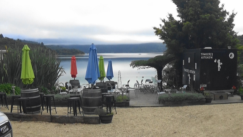
We hadnt expected any settlements as large as Okiwi Bay so hence our surprise. There seemed to be a lot of people on holiday here and with store selling petrol as well as grocery items the bay was well catered for permanents as well as holidaymakers.
Around the bay the road ventured and as it rose away from the water every so often there were glimpses of the considerable sized Croisillies Harbour so named by the French explorer DUrville in 1827 and named after his mothers home village in France.
There was still another 20km of road mainly through forest ahead of us and then soon after passing the road down to Tennyson Inlet we emerged out onto farmland with the road high above the ocean with no guard rails or vegetation of any strength to stop a vehicle from plummeting to the sea if there was any error by the driver. We quickly decided that you wouldnt want to take this road on
in low cloud even if only for the fact that there would be none of the grand scenery that was before us.
Ahead of us was the 8th largest NZ island of 150 sq km, DUrville Island which has a number of roads and a permanent population of around 50 people.
What wasnt obvious to us as we drove north along the unsealed road was just where the French Pass settlement was as the road just seemed to carry on until it disappeared out of sight before the finger of land came to an end.
At one point we came across a large flock of sheep in a sheep pen who we thought were waiting for a truck to arrive to take them off the property. This raised a bit alarm in us as we wondered when the truck might be arriving and whether we would meet it on the narrow winding road back to the main highway.
Eventually the road descended as we drove past the swirling waters the very narrow French Pass which is between the mainland and DUrville Island.