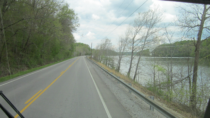
We opted to take back roads to get to the Land Between the Lakes. At times it was particularly narrow and winding, other times smooth and along the river.
We had taken a trip north to help Dad with his taxes in late March. As was expected, there was snow on our last day there. But after a pleasant week, we headed back to Alabama and time to mow the grass and straighten up and clean up from winter (such as it was there.) Then we heard from dear friends Carol and Ned Gatzke in WI. There were going to be in Ohio to see family and friends; would we be there. Dang! We had just left. So we made plans on meeting somewhere half way for a few days of camping.
We eventually settled on the Land Between the Lakes region of Kentucky/Tennessee. We headed north while they would be heading in the general direction of home in WI, just meandering a bit more south.
LBL in a national recreation area of 270 square miles of mostly unimproved land between the Tennessee and Cumberland Rivers. At one time it was sparsely populated with settlers eking out subsistence living. Settlements consisted of small family groupings with few roads and improvements. Under FDR, when he brought rural electrification to the area, he put in dams and that forced many
The Confederates had two forts, Henry and Donelson, protecting the Tennessee and Cumberland rivers. Grant easily took Henry and then marched to Donelson on the Cumberland.
to move. It was often opposed by the local residents, but eventually the land was taken and lakes were formed by the impoundments. In 1963 JFK visited the area, which had never been developed, and declared it a National Recreation Area, open to hunting, camping, swimming, and hiking. Minimal development was permitted and the area remains much as it was going back to the 1800s.
One of the interests I had in the area was its ties to the Civil War. The Tennessee and Cumberland rivers flow north at this point and empty into the Ohio River a couple of dozen miles apart. In early 1862, the Union was not doing well. Eastern fighting (northern VA) they were getting their tail kicked, repeatedly. Out west, they were cautiously moving forward. Grant worked with the Navy and determined he could advance up (i.e., go south) on the rivers and take two forts, giving the Union control of the rivers and the ability to move further south. It took a lot of talk and thought, but eventually he was given permission. So Grant advanced up the Tennessee with Navy gunboats (iron clad cannon firing water craft) and after raking Ft. Henry
Ft. Henry was at ground level and easily overtaken. Ft. Donelson was on the heights overlooking the Cumberland and took longer, with more fighting, to subdue.
and landing troops, the fort surrendered. (In truth, it was on low ground, in mud, and was not But did surrender, giving Grant a victory.) Grant then gathered the ground troops and marched about 20+ miles east to the town of Dover, TN and was to attack Ft. Donelson. The Navy gunboats went back down the Tennessee, up the Ohio to the Cumberland, and then south on the Cumberland to Dover and Ft. Donelson. There was a lot of land fighting, some ineffectual firing from the Navy at Ft. Donelson, and eventually, a breakout by 2 of the top in an effort to escape. The South was unable to assault and eventually surrendered. Terms of the surrender were classic: Immediate and Unconditional Surrender. Thus Grant earned the nickname US (Unconditional Surrender) Grant. Following this surrender, Grant gathered his troops and with permission from general, returned to the Tennessee River to continue south to Pittsburg Landing and the Battle at Shilo.
Ft. Henry is gone, much taken by the lake now formed, Ft. Donelson is still viable and it is easy to see why this fort was more difficult
Why do campgrounds think ALL sites should be Weve learned to assess the site and decide if we can reach the utility post and what kind of view we want.