The Jawoyn people, who historically inhabit the Stone Country around Katherine in the Northern Territory, believe that a rainbow serpent named Borong carved a great gorge through the heart of their land. Then from the west came a creature named Nabilil, who travelled through the gorge before camping high up on the plateau above. While Nabilil was sleeping, Walarrk the Cave Bat speared him, and in the process his dilly bag full of water was pierced, spilling out over the land and filling the gorge. At the entrance to the gorge Nabilil had heard the call of the cicada (nit nit and named the place Nitmiluk, meaning Cicada Country.
My parents had brought me to Nitmiluk NP and taken me on a boat trip through the lower sections of Katherine Gorge when I was fourteen, and now that I had finally returned to the Northern Territory nearly thirty years later, I was determined to explore this wonder of nature more thoroughly - first from above on the network of hiking trails that wind across the escarpment on the southern side of the gorge; before making my way through the very heart of the gorge with the aid of
a kayak. And though by timing my visit to coincide with the peak of the Dry Season (known as Malappar in the Jawoyn language) there was virtually no chance of any rain falling, I would have to contend with daytime maximum temperatures of around 35 degrees - despite this being the coolest time of year!
Thankfully, with Nitmiluk NP being located so far inland, the overnight minimum temperatures would be down around 14 degrees, meaning that for a few hours each morning the temperatures would be for hiking - with a typical day reaching 24° within two hours of sunrise, before soaring into the 30s by midday and remaining there until the final hour before sundown. For this reason I had decided to set my alarm for 6am each day (a full hour before sunrise) so that I could be on my way as early as possible, allowing me to get most of my walking done in the relative cool of the mornings before spending my afternoons cooling off in the various swimming holes. Well, that was the plan anyway...
to Nitmiluk NP (Sunday 25th July) I first had an orientation session with one of the resident rangers, before setting up my tent at the nearby campground. By the time I was ready to set out on my first hike it was already after midday, but with only a small daypack to carry I figured it would give me a good opportunity to acclimatise to the heat - though in doing so I merely reinforced the need to get started as early as possible in the future! With almost no breeze to speak of, very little shade and the rocky ground acting like a convection oven, my god it was hot!
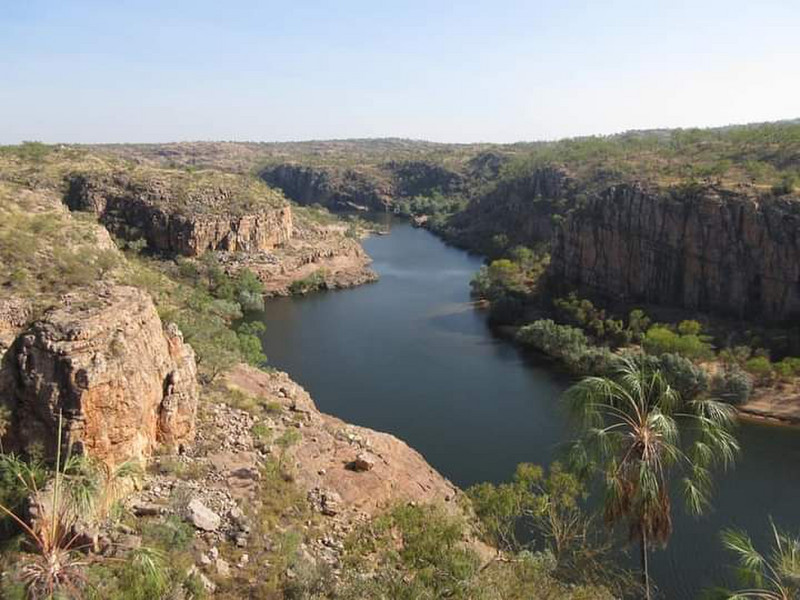
Starting with the short Baruwei Loop, I then took the to Butterfly Gorge, where a narrow valley cloaked in monsoon forest drops down between sheer walls of rock before joining the Katherine River, where I emerged at the base of towering cliffs and relished the opportunity to cool off with a swim in the waters of the Second Gorge. Turning my walk into a figure of 8 I then headed back along the top of the escarpment through the heart of the rugged Stone Country, enjoying the
most incredible views down into the depths of the First Gorge from both Jeddahs Rock and Pats Lookout. And then with daylight quickly fading I managed to make it back to the Baruwei Lookout (not far from the visitor centre) just as the last light of day was leaking from the sky, at which point the daily bat as thousands of resident flying foxes took to the skies on the way to their foraging grounds.
The following morning I was up and away by 8am - this time with a full backpack - to tackle a 50km hike that would cover almost the entire trail network on the southern side of Katherine Gorge, alternating between the two main trails that lead all the way from the visitor centre to the Eighth Gorge to form a figure route.