Our host said to us when we arrived that the weather pattern had been the same each day for a few weeks recently, cloud at dawn which gradually broke to brilliant sunshine. And this morning was no different.
The thermometer showed 2C so not much above freezing but the cloud cover was definitely clearing as arose to start the day.
It wasnt warm enough for breakfast on the terrace so we planned our day inside as we fed ourselves getting bolstered for a walk along the shores of Lake Rotoiti going as far as we thought we could manage with the knowledge that we also had to walk the same distance back to the car.
We wanted a bit more knowledge of the trails along and around the lake shore so the obvious place was the DOC station close to the lakes edge.
We got to the DOC centre at the wrong time as the information desk was closed although a notice did say it would be open again in 10 minutes, although that was 20 minutes ago by our watches. Perhaps the staff was having a long morning tea. So we were left to make up
The right hand side, looking south, had an advantage that you could drive part way to a point where you could start the trail already well on the way to an ultimate goal of the trailhead hut at the far end of the lake. This would probably shorten the distance to walk to the hut and back although without a detailed map of the trail you couldnt be certain this would be so.
There were two things that could prove difficult with this idea. One was the total distance and time taken the walk according to ‘Mr Google. At 7 hours we decided this was a bit too long for our current level of fitness and with Gretchens dodgy knee. The other thing was from Google Maps it showed that the end of the lake morphed into the Travers River with a dotted line across the water, from bank to bank. Just what this dotted line meant
was open to interpretation. If it meant you swam or waded across that wasnt going to be on for us and almost as unlikely was us taking to a swing bridge again after the end of the Heaphy track incident 18 months ago when we were delayed getting across a river by swing bridge when squalls kept arriving from the Tasman Sea making the bridge swing violently. Perhaps there was a water taxi!
From the lake shore we could see what appeared to look like a beach before a point jutted out into the lake. What was beyond that was not visible and therefore didnt tell us how much further it was to the hut.
The first part of the walk had a lot of information on labels under trees telling you all about the type the tree was etc etc.Eventually these information labels ran out and we decided that we were now onto the part of the trail that was for more serious walkers than nature strollers. Not that the trail was more difficult
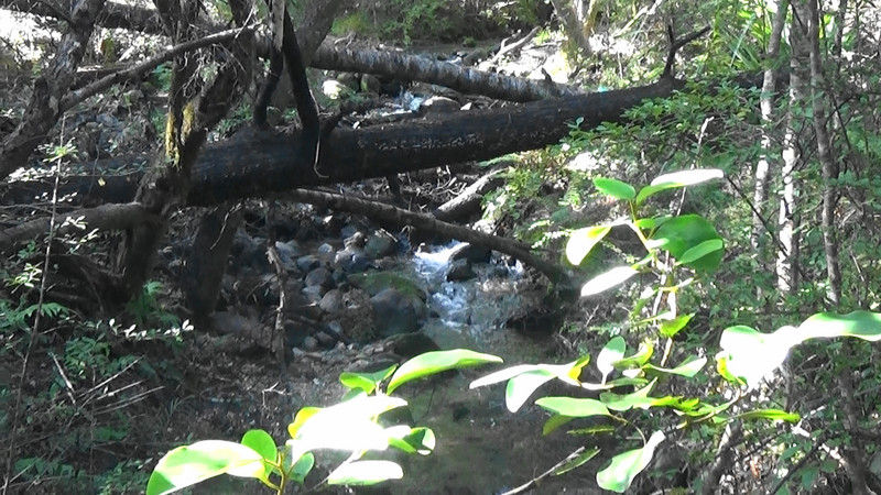
or narrower and it continued on with just low rises here and there to cross streams or where running the trail close to the edge of the lake would have meant removing more vegetation and trees to give a clear path.
After 20 minutes or so of walking we met a group of 4 people who had started out earlier than us and got to their zenith on the trail before turning around and were on the return to the car park.
It is apparent that there were few people on holiday in the area as there werent a lot of vehicles in the car park and anyway there were a number of other trails people may have taken.
A couple of times as we strode south along the trail we found a break in the bush of less density to edge our way through to get onto a small stony beach to look back and see how far we had walked from the car park.
At our second stop on a beach we looked ahead south to where a point jutted out into the lake and we decided that the beach at that point would
Along the way there had been boardwalks where the ground underneath was a bit boggy and walking above would preserve it.