We didnt sleep well after seeing a message from Microsoft just before turning out the lights. It was a notification that a hacker from Moscow had logged into his account. He reported it, but wasnt sure what else to do...
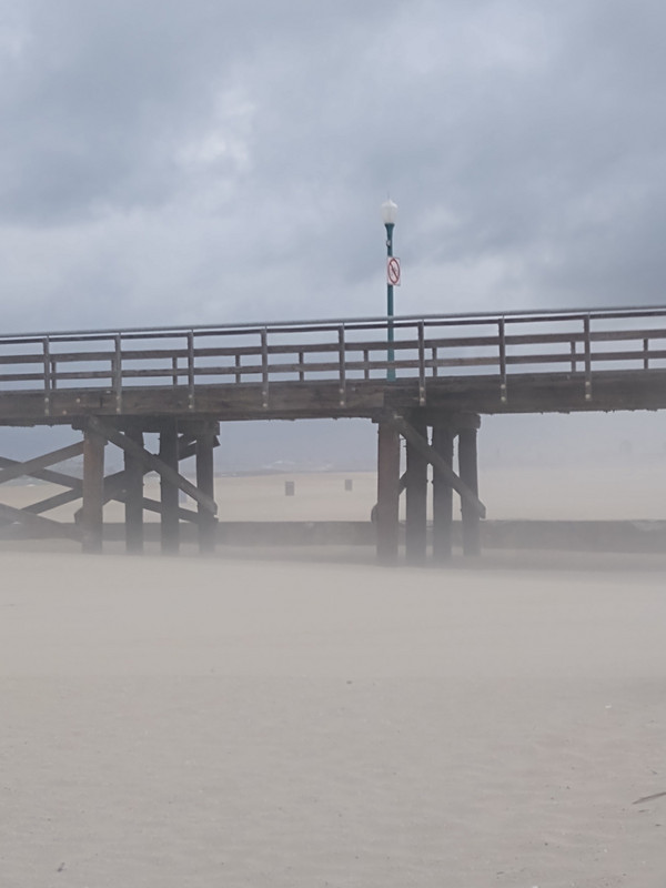
Once we were up, we saw a note reminding us that the car had to be moved to the opposite side of the street for cleaning before 9:00am. Char and Jose had already for their teaching jobs. Bill went to look for a parking place but had no luck, so we decided to load up the car and I would go for a run on the beach, instead of in the neighborhood. We drove to beach where the predicted storm had already hit and the sand was blowing hard, so no run and no swim...The temperature was 59.
We drove a few miles to visit other Seal Beach friends, Jim and Kathy Adams. It was a bit early, but they let us in! They chatted and I went for a run in the drizzle. After we left, the weather got windier and wetter as we headed south along the coast. The beaches were closed due to the storm, so
We left the coast at San Diego, and headed east towards Yuma, Arizona, where we would spend the night. The scenery was amazing...fields of giant boulders for miles and miles. The Mountains consist of faulted granitic intrusive bedrock, weathered into dramatic piles of residual boulders. The local granodiorite is naturally a very light color, weathering over centuries into a desert varnish.
My son had told me about the sand dunes outside of Yuma, and we planned a stop there. I googled the sand dunes and the directions said to take the next exit which we nearly passed...Bill skillfully drove us off the ramp, and then I realized we had 30 miles to go to get to the Imperial Sand Dunes Park. The roads were terrible and Bill was refraining from judging me too harshly...we ended up turning around and going back to the freeway, once I realized we could have just continued on Interstate 8 and had better views...
over a wide area, being periodically diverted in one direction or another by silt deposits remaining after floods. Sometimes the river flowed into the Gulf of California, as it does today (no longer flows into the Gulf of California due to irrigation in the Imperial Valley and Mexicali Valley); other times it turned westward toward the Salton Sink. Each time the Salton Sink received the river flow, a large freshwater lake called Lake Cahuilla formed. The last Lake Cahuilla covered much of the Imperial, Coachella and Mexicali Valleys as late as 1450. The most popular theory holds that the Algodones Dunes were formed from windblown beach sands of Lake Cahuilla. The prevailing westerly and northwesterly winds carried the sand eastward from the old lake shore to their present location which continues to migrate southeast by approximately one foot per year. The field is approximately 45 miles (72 km) long by 6 miles (9.7 km) wide and extends along a line that correlates to the prevailing northerly and westerly wind directions.
We crossed the dunes, and drove along the border wall for a bit. The wind was so strong I could barely close the car door when we stopped for photos! The air
We arrived in Yuma around 5:00pm and I had hoped to swim in the Colorado River, but after charging and checking into our motel (an old remodeled building along the main road into Mexico), I didnt feel like getting into the car again, so my swim today was in the little pool at the motel...