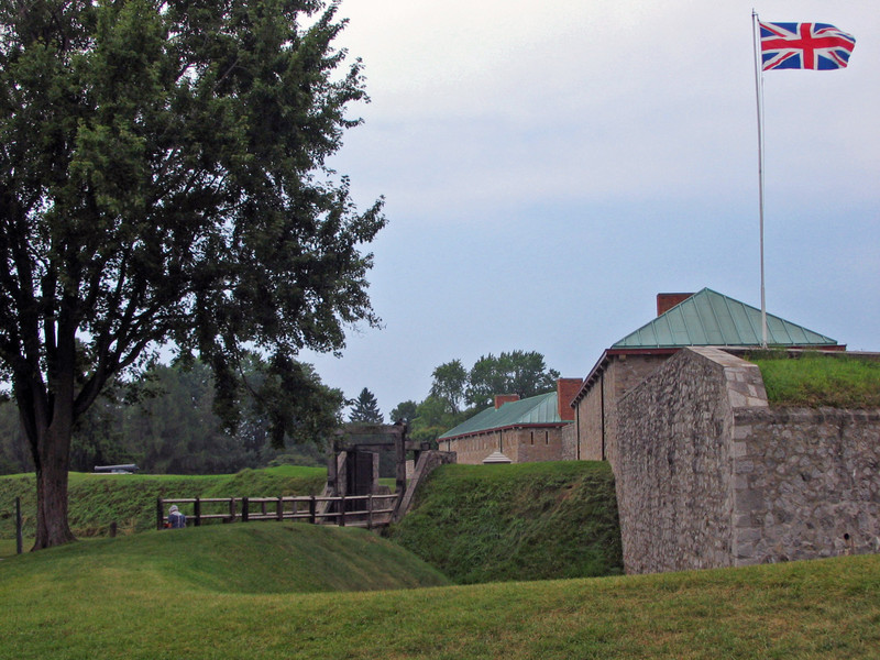
Built by the British in 1764 following the French and Indian War. a focal point in the War of 1812. Restored in National Historic Site of Canada. IMG_1496p1
Today was the day to drive the opposite way along the Parkway and see what lay south of Niagara Falls. The drive in the direction of Lake Erie takes one along the Niagara River before it goes over the falls. A landmark of sorts is the wreck of a coal barge that has been sitting out in the river since 1912. When you see it, you think it must be a more recent occurrence. It is said that eventually the wreckage will break free and go over the falls.
The town of Fort Erie takes it name from Old Fort Erie. Old Fort Erie was built in 1764. It dates to the end of French and Indian war period and was the first British fortification in the region. The forts barracks, officers quarters, powder magazine, and kitchen have interpretive displays. Outside, one can roam the parade ground and the outer defenses. During the War of 1812 US troops attacked and occupied the fort twice.
I had a very pleasant chat with a Canadian reenactor standing guard at the entrance. He was well versed in the areas history and spoke of how there was little regard for the border up
to the War of 1812. Families married and moved back and forth at will. The War of 1812 changed all that. There was heavy fighting up and down the Canadian side of the river. Canadians view that war and the American invasion as a pivotal event in the formation of their national identity. Since the end of hostilities in 1814, the US and Canada have enjoyed a peaceful relationship. Near the fort, the Peace Bridge spans the Niagara River linking Buffalo, NY, and Fort Erie, ON.
On the way back to Niagara Fall, we stopped at the Fort Erie Railway Museum. I had seen the sign for it on the way in and kept it in mind. A restored depot, steam and a caboose are on display here.